Geospatial Solutions

Geospatial Information Resource Limited is your trusted partner for innovative IT solutions and professional surveying services. Since 2010, we have been delivering excellence in software engineering, cloud computing, data analytics, and geospatial intelligence while providing precise cadastral, topographic, GIS, and engineering surveys. By blending digital transformation with geospatial expertise, we help businesses, governments, and organizations make smarter decisions, optimize operations, and achieve measurable results.

Our Services

IT Transformation
IT & Digital Transformation Solutions

We design and deliver advanced technology solutions, including software engineering, data analytics, machine learning, and cloud services. Helping businesses modernize, unlock insights, and achieve sustainable growth.

Surveying
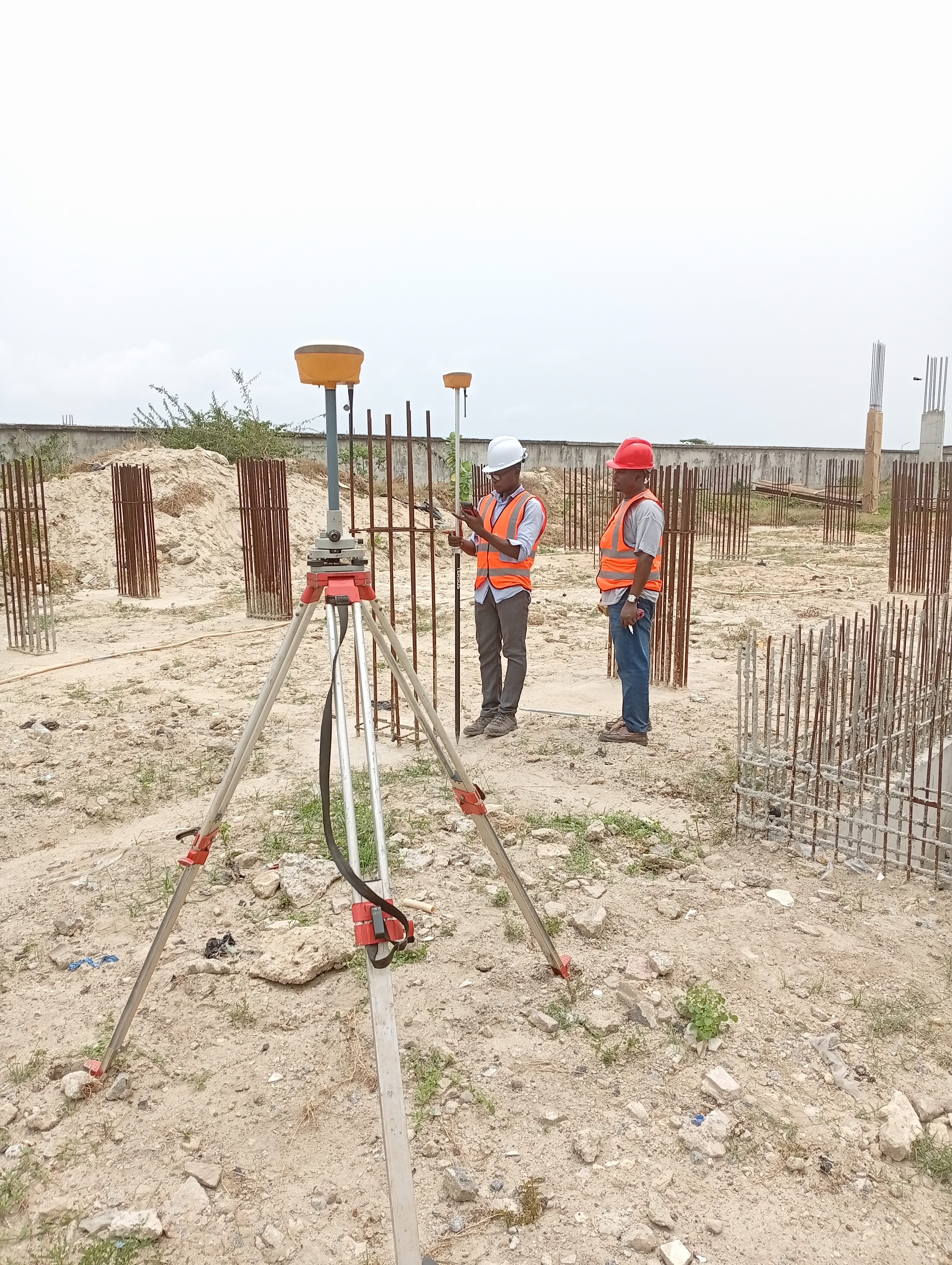
Surveying & Geoinformatics Services

Our licensed surveyors provide cadastral, topographic, engineering, and hydrographic surveys with estate layout design. We ensure accuracy, compliance, and reliability in all land measurement projects.

Enterprise GIS
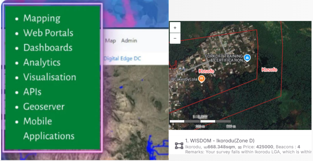
Enterprise GIS Software Development

We create enterprise GIS tools for asset mapping, spatial analysis, and decision support, enabling smarter planning and resource management for organizations.

Engineering Services

We offer civil, structural, electrical, and architectural engineering solutions. Our integrated team plans, designs, and executes projects with precision, efficiency, and innovation.

Our Tailored Services

We develop scalable, high-quality software applications β€” from web platforms to mobile apps β€” ensuring reliability, efficiency, and easy maintenance tailored to your unique business requirements.

We design and develop robust Enterprise GIS applications that empower organizations to collect, analyze, and visualize spatial data seamlessly. Our solutions integrate advanced mapping technologies with business systems, enabling smarter decision-making, real-time data access, and improved operational efficiency across industries.

We deliver precise surveying and comprehensive mapping solutions to support infrastructure development, land administration, and environmental management. Our expertise covers geodetic control, cadastral surveys, and high-resolution state-wide mapping using advanced GNSS, aerial imagery, and GIS technology. With accuracy and efficiency at the core of our operations, we provide reliable geospatial data for planning, decision-making, and sustainable development

Our Building and Construction Engineering services combine precision design, advanced project management, and sustainable building practices to deliver projects of exceptional quality. From concept to completion, we ensure every structure is functional, durable, and aligned with regulatory standardsβ€”meeting client needs while optimizing cost and efficiency.

We provide secure, scalable server infrastructure and cloud-based solutions that ensure high performance, data reliability, and seamless accessibility. From deployment to maintenance, our services help organizations optimize resources, reduce costs, and operate with greater flexibility.

Industries Reached

Our services cut across all industries where data is used from data gathering, engineering, infrastructure, analytics, to storage. Wherever data exists, we deliver solutions.

πŸ’» IT / Software Development
πŸ›οΈ Government (Federal & State)
πŸͺ– Military / Defense
πŸŽ“ Higher Education
🚒 Maritime / Transportation & Logistics
πŸ“‘ Media & Telecommunication
πŸ›’οΈ Oil & Gas
🌾 Agriculture
🏒 Real Estate / Property Development
🏦 Banking & Insurance
πŸ”¬ Research & Development
πŸ“ Engineering & Mapping

Our Team

Damilola
Surv. Damilola Kolawole MNIS
MD / CEO
Damilola
Engr. Michael Adeyinka MNSE
Structural Engineer
Abolade
Abolade Olawuyi
Surveyor / Front End Developer
Habeeb
Habib Abdulsalam
Surveyor / Database Administrator
Omolola Bassey
Dr. Omolola Bassey
Research & Capacity Development
Omolola Bassey
Arc. Jatto Joseph
Lead Architect
Olowe
Engr. Segun Olowe
M & E Engineer

Our Clientele

Nigerian Institution of Surveyors
National Space Research and Development Agency
LUTEK Continental Services
Nigerian Army
Nigerian Army
Lagos State Government
Imo State Government
Nigerian Navy
Nigerian Navy
Deeper Christian Life Ministry
Federal Ministry of Agriculture

Contact Us

Geospatial Information Resource Limited

πŸ“ 20, Oduyemi Street, Ikeja, Lagos, Nigeria

πŸ“ž +234 806 086 1809

βœ‰οΈ info@geospatial.com.ng